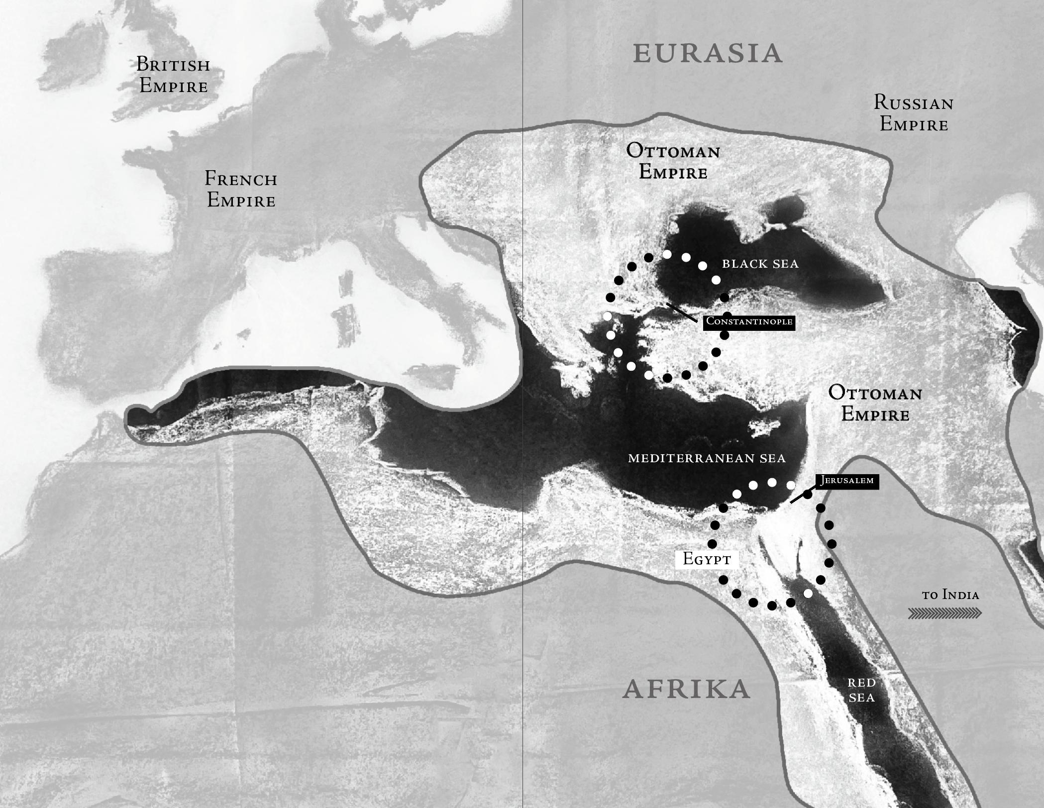
By the time the Ottoman Empire completely collapsed in 1922, it had been slowly losing territory for more than two hundred years. The Empire had reached its maximum extent in 1683, on the eve of the Battle of Vienna. It had failed to capture Vienna.
From the perspective of Europe, it became evident that possession of the Ottoman territories would soon be thrown into question and their capture by Europe itself would throw into question the balance of power between Europe’s various empires.
The British, French, and Russian empires, all descendants of the Roman Empire, had coveted the Ottoman territories. At the time of the Ottoman’s decline, the British were the most militarily powerful of the three. Whoever got those lands would enjoy immense riches, they believed, and not just on earth but in the hereafter.
Jerusalem was there.
The Russian Empire in the east wished for a port with warm water year-round. It sought control over the Black Sea and its connection to the Mediterranean Sea right at Constantinople, taken earlier by the Ottomans in 1453.
In 1798, the French Empire was losing Haiti in the Caribbean to a slave revolt. To make up for the loss of its most valuable colony, the French planned to steal Britain’s most valuable colony: India in South Asia.
Instead of directly fighting the British, Napoleon turned his warships to non-Europe. He boarded soldiers and scientists alongside him on expedition to Egypt. His strategy was to take India by simply getting to it faster than Britain. At the time, the Europeans were still having to round Southern Afrika to get to Asia.
Napoleon planned to cut a canal between the Red Sea and the Mediterranean, the future Suez Canal.
Napoleon would fail, but the idea lived on. In 1859, the British would begin cutting the Suez Canal, displacing many, including the Nubian peoples who wear black clothing today in mourning, demanding their return to their ancestral lands when they will again wear their traditional white clothing.
After some early victories in Egypt, Napoleon and his French expedition returned to Europe in defeat. The British had stepped in, allowing the Ottoman Empire to live on so it would not be conquered by France.
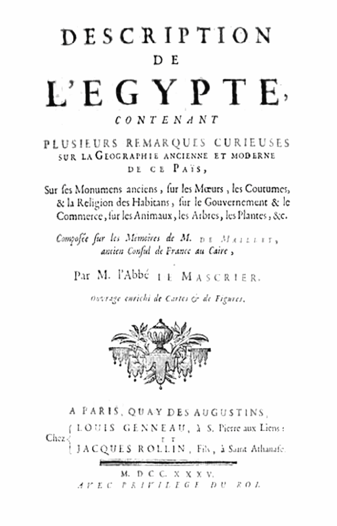
Still, that Europeans had managed to stay in the Holy Land as long as Napoleon had stayed was momentous news for Europe, and in that way, the French expedition was a success. It led to the publication of the Description de l’Égypte from the findings of Napoleon’s scientists. First published in 1809, the encyclopedia would travel across the Atlantic and inspire a type of “Holy Land mania” from Europe to America.
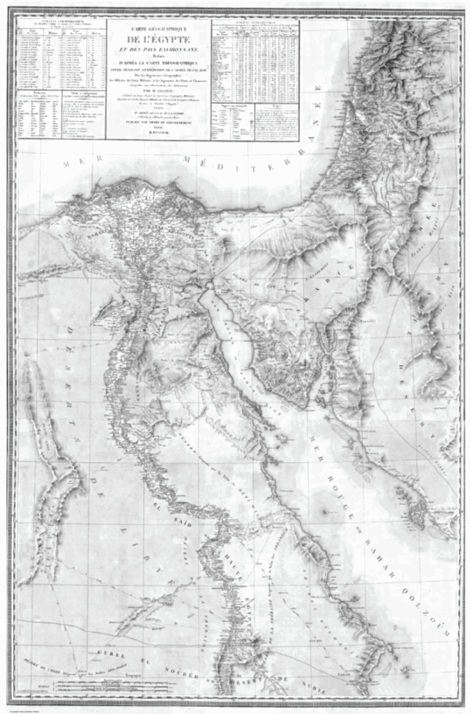
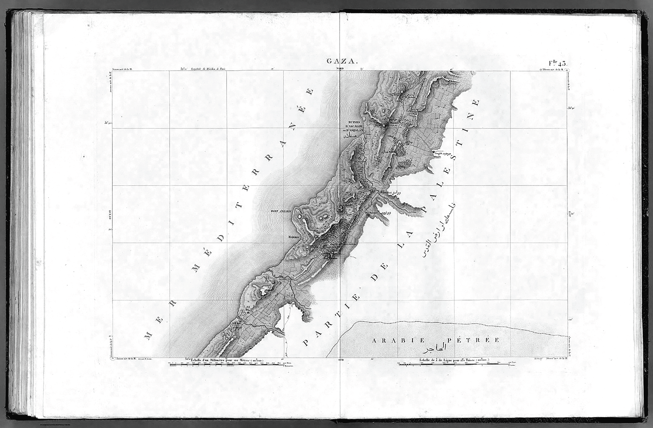
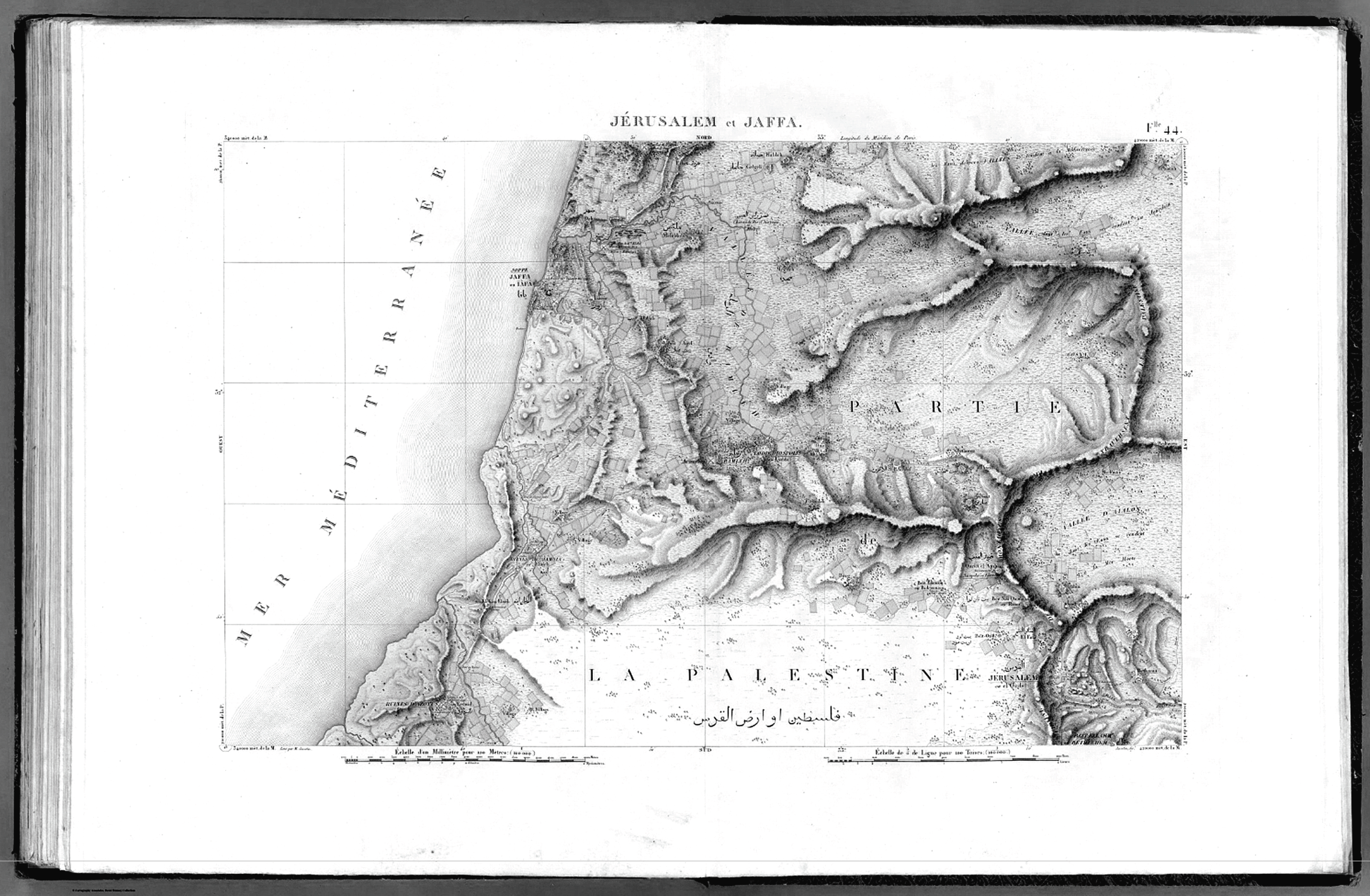
The map below consists of 47 sheets and starts at the south end of Egypt, follows the Nile, and then up to the Delta in the north. Palestine appears on the eastern banks of the Mediterranean Sea.
The map is considered the first triangulation-based survey of Egypt and Palestine, the area’s first scientific map, meaning its results could be replicated by others using the same measurement techniques.
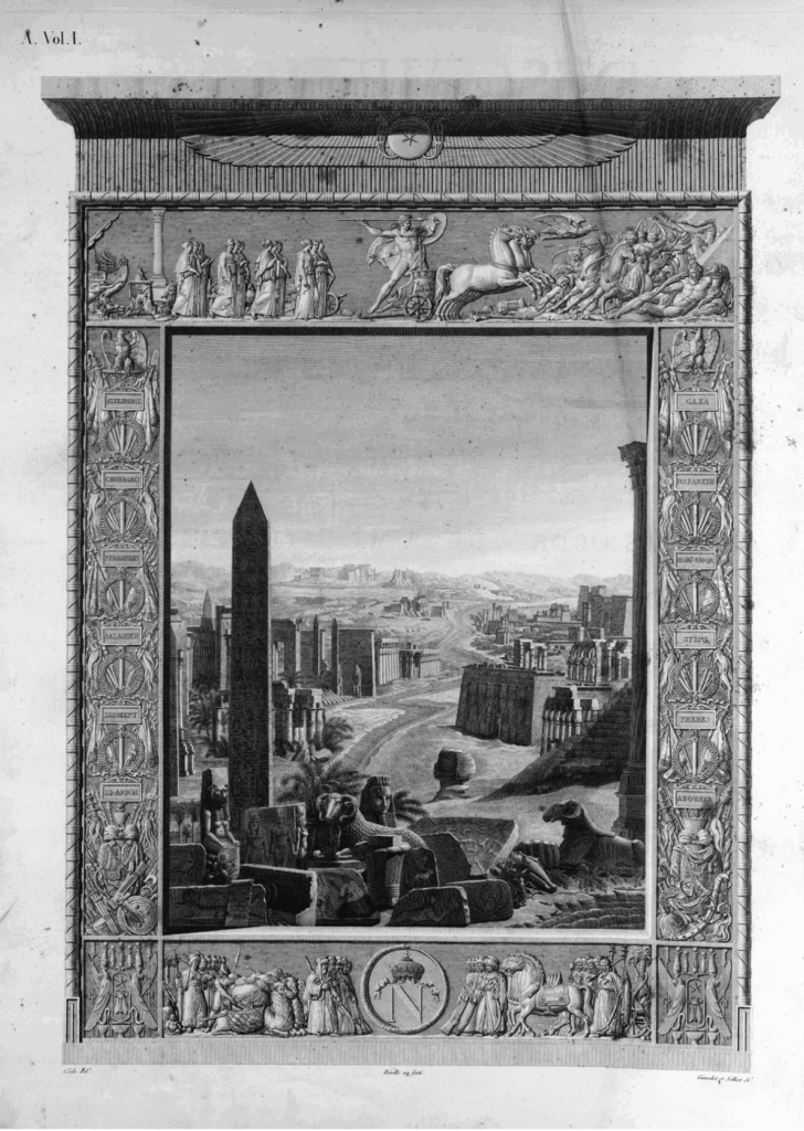
The frontispiece to the first edition of the Description de l’Égypte shows an obelisk, the inspiration for the Washington Monument built later in 1848.
Below are Sheet 43, Gaza and Sheet 44, Jerusalem and Jaffa. While the coast is mapped relatively accurate, the French expedition did not survey Jerusalem but included it for its great significance to readers of the encyclopedia.
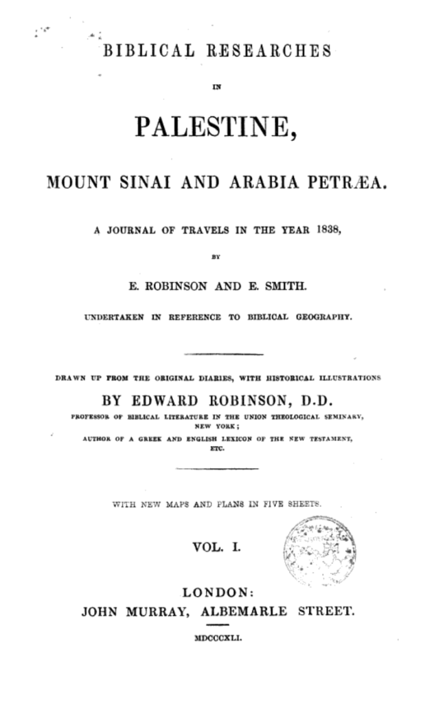
Napoleon and Them’s encyclopedia inspired many Christian Evangelicals who interpret the Bible literally instead of metaphorically. This included Edward Robinson, a professor of Biblical literature at Union Theological Seminary in New York.
In 1838 Robinson and a translator traveled to Egypt and Palestine, wishing to use science to prove Robinson’s interpretation of Christianity true. With Bible in hand, they traveled the country and encountered the communities living in the land, mapping the region’s ancient Biblical place names by listening for echoes of the Hebrew spoken in the Arabic of Palestine.
Robinson’s Biblical Researches in Palestine, Mount Sinai and Arabia Petraea was published simultaneously in the United States, England, and Germany. It became a cornerstone of nineteenth century Palestine exploration and made Robinson known as the Father of Biblical Geography.
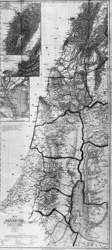
The maps illustrated by his German mapmaker below have been described as the beginning of Modern cartography of the Holy Land. Notice how the map extends to the east beyond the River Jordan and Dead Sea.
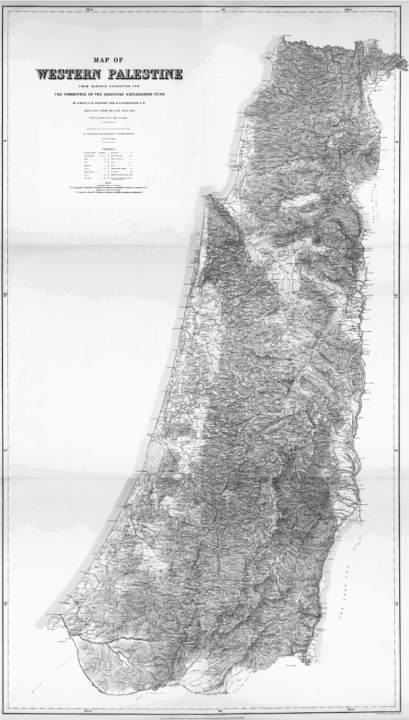
Some thirty years later, the British War Department began producing the first scientific map of Jerusalem, the Ordnance Survey of Jerusalem. Ordnance surveys are maps that cater to military strategy, and Britain’s Ordnance Survey had been born out of its need to crush rebellion in Scotland one hundred years before.
The same Biblical archaeologists and clergymen who supported Jerusalem’s Ordnance Survey would soon found the Palestine Exploration Fund (PEF) in London. In its first meeting in 1865, the Archbishop of York and first President of the Fund famously announced: “This country of Palestine belongs to you and me, it is essentially ours,” making clear Palestine belonged to England, not to Palestinians.
Under the cover of science and religion, British war engineers would survey Palestine between 1872–1877 and complete the Survey of Western Palestine below.
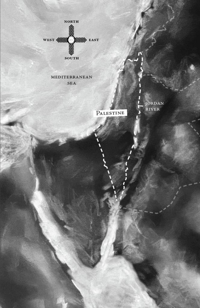
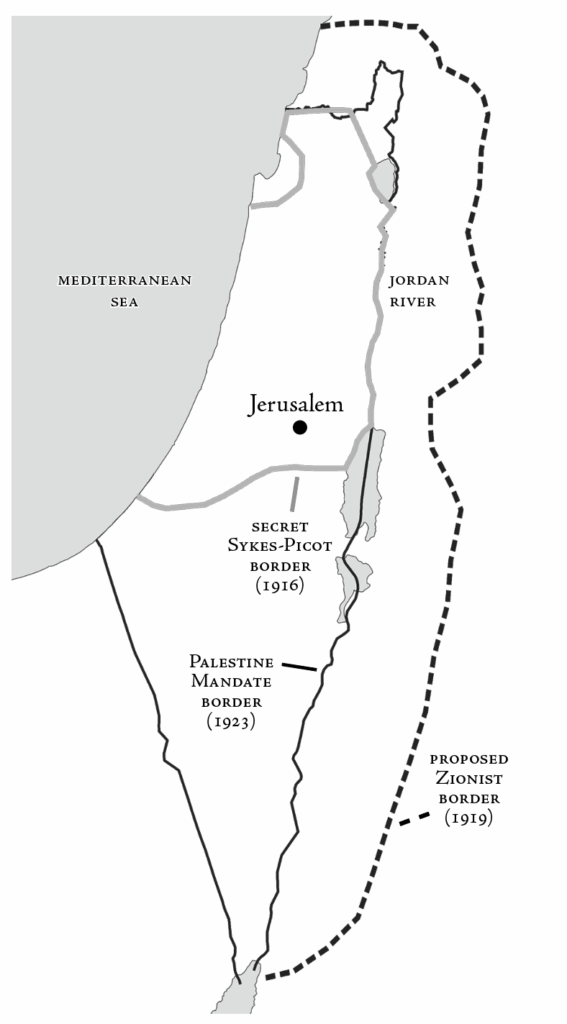
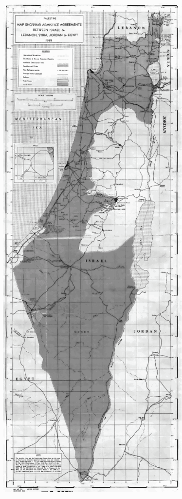
The PEF’s younger counterpart, the American Palestine Exploration Society (APES) had failed to complete the survey east of the Jordan River that it had been assigned by the more established PEF. This accident of history caused Palestine’s eastern border to stop at the River Jordan.
Forty years later during the First World War, the PEF Survey of Western Palestine would help British Army soldier Edmund Allenby capture Jerusalem by Christmas in what the British called the Last Crusade. The Survey’s shape of Palestine would become the footprint of the borders of Palestine in 1923 from the River to the Sea.
In 1917 still in the midst of the First World War against the Ottoman Empire, the British promised to hand over Palestine to Europe’s Zionist movement through the Balfour Declaration.
The Zionists would disapprove of what would become Palestine’s borders in 1923, fully expecting its eastern border to have extended well beyond the Jordan River, farther east.
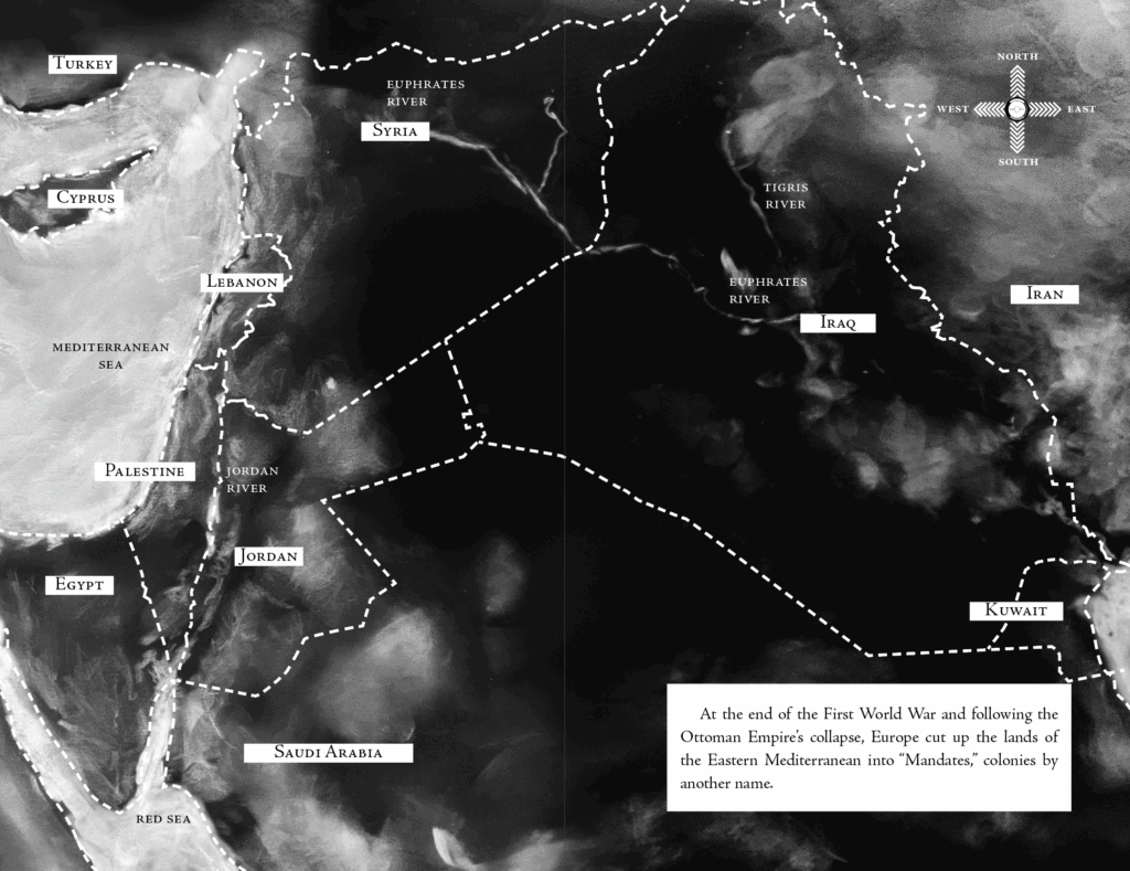
At the end of the First World War and following the Ottoman Empire’s collapse, Europe cut up the lands of the Eastern Mediterranean into “Mandates,” colonies by another name.
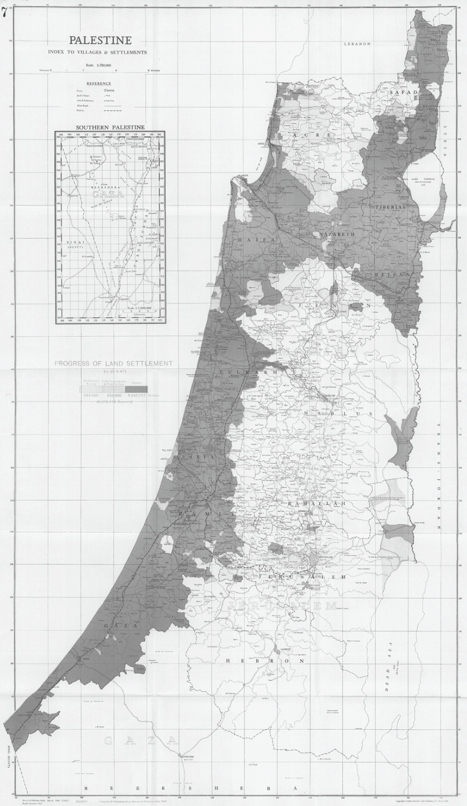
In 1920, the British began another Survey of Palestine, this time cutting up the land into private property lots, a cadaster map with each lot titled to an individual owner. Surveying and settling the title of land to an individual facilitated the land’s sale to European settlers who readily expelled the Palestinian communities who lived there once they became owners.
The amount and location of Palestine’s land surveyed by 1947 would correspond closely to the land the United Nations would allot to the proposed Jewish State in its Partition Plan for Palestine that same year.
The expulsion of Palestinians from their lands as the Survey progressed led to a much earlier intifada, the Arab Revolt of 1936–1939. In its investigations on the revolt, Britain’s Peel Commission reported that throughout the countryside, Palestinian peasants were breaking the surveyor’s instruments and halting the Survey’s progress.
The Peel Commission proposed a partition of Palestine in 1937 allotting the surveyed lands to a future Jewish State and adding an international corridor to maintain European access to Jerusalem from the Mediterranean at Jaffa, with “international” meaning European.
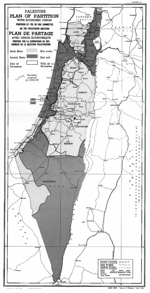
The United Nations Partition Plan for Palestine in 1947 allotted the surveyed lands to a Jewish State along with large swaths of the Negev Desert in the south to accommodate the further transfer of Jews out of Europe.
The newly created United Nations General Assembly had just approved the partition of Palestine into an Arab State and a Jewish State and a special “international” regime for Jerusalem and its surroundings, including Bethlehem. The plan implied the forcible transfer of Palestinians from the area allotted to a Jewish State.
Of course the Palestinians refused.
In 1948, Zionist militias armed by Europe successfully went to war against the resistance, which also came from Egypt, Jordan, Iraq, Syria, Lebanon, and Yemen. Approximately 750,000 Palestinians, about half of the Palestinian population at the time, were expelled from their homes or made to flee through various violent means to live in refugee camps in the Gaza Strip, West Bank, Jordan, Syria, and Lebanon.
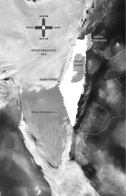
The Nakba resulted in the establishment of the State of Israel up to the edges of Jerusalem. No Palestinian state was created. Jordan would control Jerusalem and the rest of the West Bank, and Egypt would control the Gaza Strip until 1967 when Israel would take those lands too.
In 1967 through more war, Israel expanded its territory by capturing Jerusalem and the rest of the West Bank, the Gaza Strip, Sinai Peninsula, and the Golan Heights. It immediately began building settlements in them all. In 1979 Israel would eventually return the Sinai Peninsula to Egypt in exchange for peace in a deal brokered by the United States, for which Egypt would become the second-largest recipient of military aid from the United States after Israel, the first-largest recipient.
Israel today still occupies the Golan Heights, originally mapped as part of Syria in the 1920s. Israel’s border with Syria had remained quiet for decades until May 15, 2011 during the first months of the Arab uprisings, when thousands pulled up on buses from Syria and marched toward the Golan Heights, Palestinian flags in hand. Their Golani kin on the other side of the fence had cheered at first but shouted in disbelief the closer the protesters approached. Bikafi! they pleaded, warning of the landmines near the fence. Enough! Still, the protesters kept on and answered back, “al-sha’b yurid tahrir Falesteen!” The people want the liberation of Palestine. About a hundred of them jumped the fence, entered, and dispersed. Stunned Israeli border guards recovered quickly and opened fire, wounding and martyring several. The rest were captured and deported back to Syria, but one Palestinian refugee had slipped through. Hassan Hijazi hopped on a public bus and reached Jaffa, the place of his grandfather’s birth. After searching for his family’s house with no luck, he contacted an Israeli television correspondent and by evening turned himself in to the police. He was soon deported to Syria but not before his message was relayed to Israelis that Palestine’s refugees had returned.
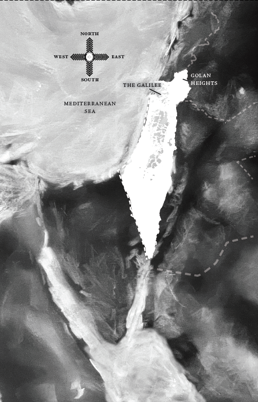
In 1948, when Zionist militias expelled half of Palestine’s people from the land, the half that remained were placed under martial law by the State of Israel until 1966. During this time, Palestinians inside ‘48 were governed by military rule and subjected to travel permits, curfews, and detention. Many continued being expelled from their homes and lands in the Galilee, homes and lands transferred to Jewish settlers or Israeli institutions. Israel has since forced citizenship onto them but continues to treat them like second-class citizens. The ‘48 Palestinians are often forgotten even by many Palestine awareness maps of Palestine whose focus stays mostly on the Gaza Strip and West Bank.
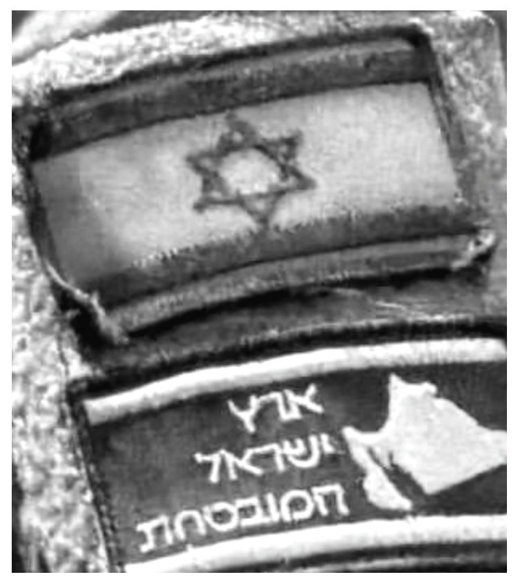
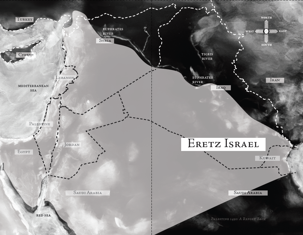
Also regularly forgotten on awareness maps is the Golan Heights, but the territory is certainly included in the mental maps of what Israelis believe their borders to be. But Israel has never defined its borders for Israel is not done expanding. According to Zionist mental maps, Eretz Israel, the Land of Israel, is supposed to expand further east to the Tigris and Euphrates Rivers in modern-day Iraq. On Israeli military uniforms the Eretz Israel map reminds Zionist soldiers of the larger territory they’ve been conscripted to kill for.
The image below is from a social media post shared in June 2024 by nine-year-old Lama Jamous.
In the midst of Israel’s escalated genocide in the Gaza Strip, Gaza’s youngest journalist had a question for the world about the map under the Israeli flag: